Over the past week, I’ve been taking I-87 North to scout in Rockland County…
…which means I’ve spent about an hour each day stuck in this:
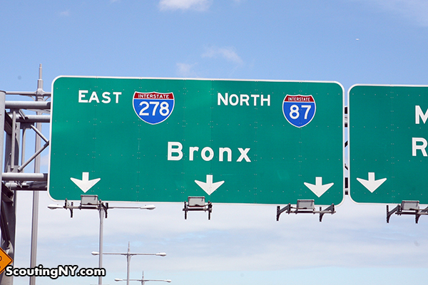
As anyone who travels it regularly knows, I-87 can be a hellhole of traffic due to the unholy convergence of multiple interstates and local bridges in the most inopportune way imaginable. That said, I have noticed a few interesting things as I’ve inched along at a snail’s pace. Hopefully, this guide will make your commute slightly more bearable.
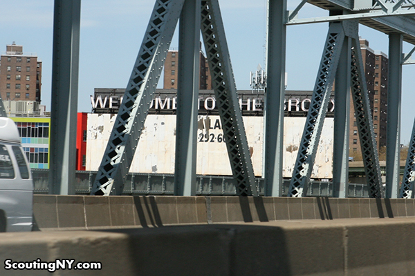
Let’s start at the very beginning. Before you merge onto 87 via the Triboro, be sure to glance to your left to note the iconic “Welcome to the Bronx” billboard.
I love the typeface, and it kills me that no one has bothered to properly wire the neon back into operation. How amazing would be if you saw this sign glowing as you entered The Bronx at night? Then again, I can’t even remember the last time this billboard had an ad, so I doubt it’s happening anytime soon.

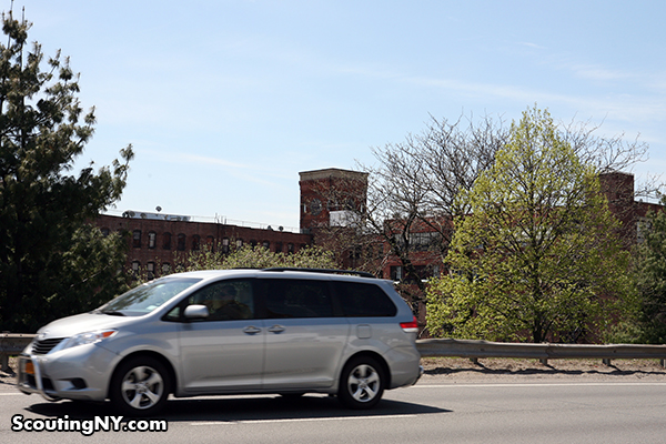
As you merge onto 87 (and promptly come to a complete standstill), look to your left to take in some of the gorgeous factory buildings of the South Bronx’s Mott Haven neighborhood:
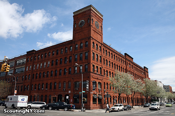
In fact, if traffic is ever particularly bad, you might want to take a quick detour through to see them up close. The crown jewel is the Clocktower building…
…which, for my money, is one of the most beautiful buildings in the city.
Built in 1885-6, it was originally home to Estey Pianos, at a time when piano factories were a common sight throughout the South Bronx.
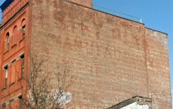
It was converted into a residential building several years ago, and as the neighborhood has gentrified, rents have nearly doubled. You can still make out the Estey name in a fading ghost sign at one end of the building:
Also visible from the highway, love this restored Department of Sanitation building at the east end of Bruckner…
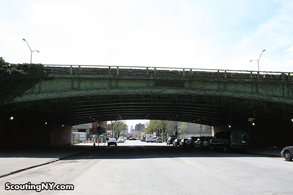
Continuing on 87, you’d never know it while driving, but at Alexander Ave, you pass over a very nice ivy-covered bridge.
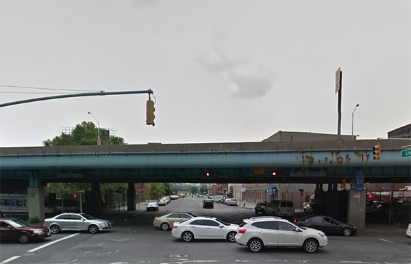
Absolutely no clue why this little bit bothered to be different from the rest of the highway overpasses, which pretty much all look like this…
…but man does it look pretty in the summer:
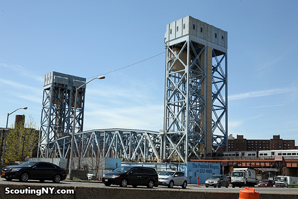
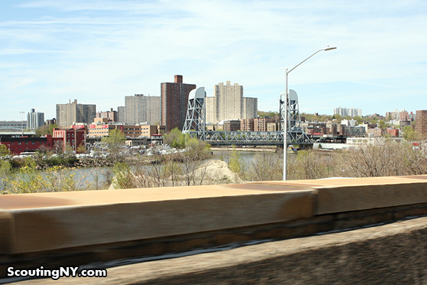
Continuing north at 3 miles an hour, look to your left to see the impressive Park Avenue Railroad Bridge. Built in 1956, this is the third bridge at the site (the first was built in 1841) and raises to a height of 135 feet. Don’t expect to see it in use though – the lift is no longer operational.
This next one is kinda weird, and you have to look quickly. As you approach the building under construction, glance to your right…
…and you’ll see an enormous horse laying on its side with no explanation whatsoever:
I had to check this one out in person. As it turns out, the building it’s resting on is a company that deals in outdoor advertising. The horse is a remnant from an ad in Times Square…
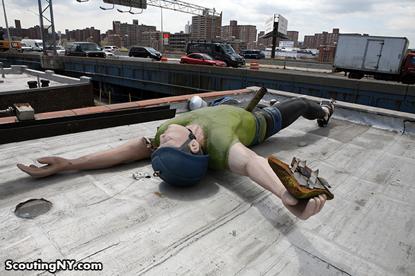
…and if you’re really quick, you’ll also see this enormous guy lying next to it:
At first, I thought he was a jockey, but then someone pointed out he looks more like a rock climber. A close-up:
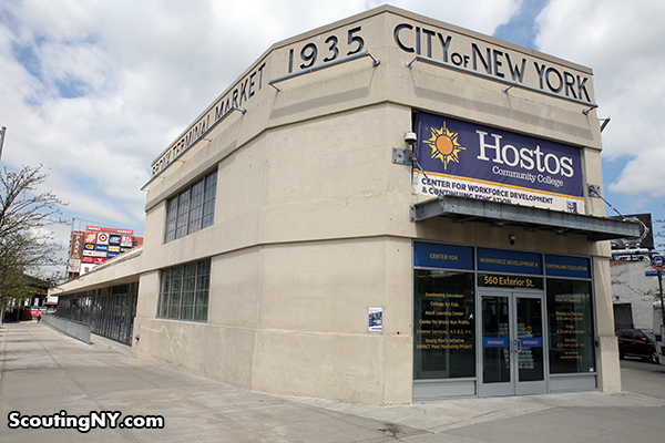
Just ahead, you’ll pass the Bronx Terminal Market on your right:
Known as the Prow Building, this is one of the only remaining structures from the Bronx Terminal Market complex, built in 1935 to house the city’s pushcart vendors. The Prow building once housed a bank, as well as a hotel for farmers on the second floor:
Love the classic typeface:
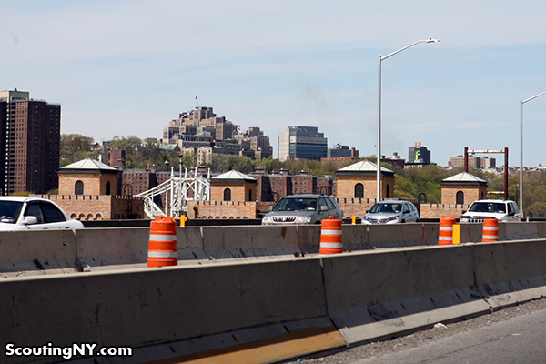
As you wonder whether it’s possible for your car to move any slower than its idle speed, you might wonder what the hell all those castle-like turrets are poking up on left side of the highway:
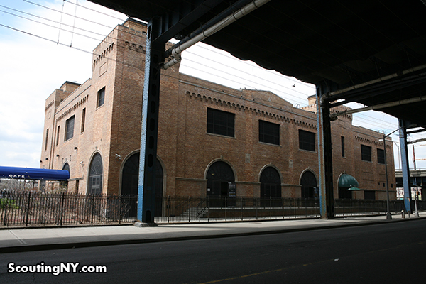
This is the Power House, also a part of the Bronx Terminal Market. It was built in the mid-1920s to allow for temperature-controlled food storage for perishable goods.
It was renovated in 2010 by the Parks Department as part of its Mill Pond Park project.
Off to the right, you’ll see the latest Yankee Stadium, opened in 2009 to serve as conclusive proof why Fenway Park should never, ever be torn down. Pretty much all the apartment buildings beyond have an unconfirmable story about a Yankee legend having lived there.
As you see an opening and attempt to merge lanes for a miraculous 5-foot leap in travel distance, look left and you’ll spot the Macombs Dam Bridge, the third oldest in the city after the Brooklyn Bridge and Washington Bridge. Dating to 1890, it was named for a dam built on the site to power a gristmill in 1814. Love the little operator towers:
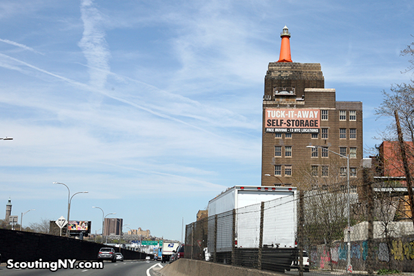
Coming up on the right is the first sign that you’re almost – almost! – past the utter horror that is 95 on-ramp congestion: the rooftop lighthouse!
Quite possibly the most famous sight along 87, this 30-foot tall iron lighthouse sits atop the former headquarters of the H. W. Wilson Company, a book printing company dealing in reference periodicals (the lighthouse is their logo). Why the garish orange? The building was purchased by Tuck-It-Away storage in 2012, who changed it to match their color scheme (ugh).
As you’re finally squeezing past the lanes of traffic merging onto 95, glance left…
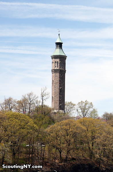
…and you’ll see the gorgeous High Bridge Water Tower, built in 1866-72 to increase the city’s water supply:
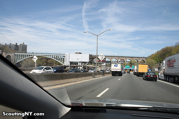
Up ahead, you’ll see High Bridge itself, completed in 1848 as part of the Croton Aqueduct to channel water 10 miles south to New York. In 1928, the five masonry arches spanning the Harlem River were replaced by the current steel arch.
Closed for decades, the bridge has recently been converted into a pedestrian walkway and will supposedly re-open soon:
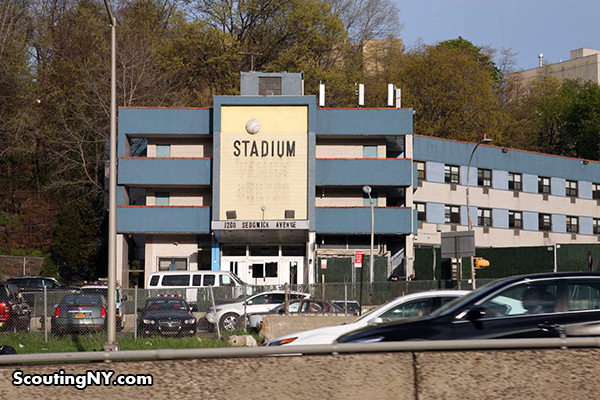
Just before you travel under the bridge, I’ve always wondered about the building on the right, which features a baseball and says STADIUM, even though it’s clearly not. Despite the sports theme, it’s actually a homeless shelter.
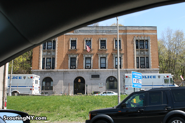
Next to it is a pretty classic NYC precinct house (44th) sitting all by its lonesome:
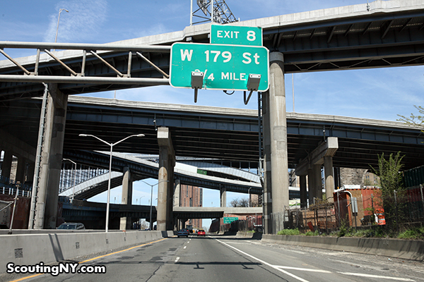
Driving on now at a brisker pace, marvel at the tangles of bridges and overpasses that somehow manage to get everyone where they need to go (very slowly).
Just beyond, you’ll come to the northernmost point in Manhattan, where Spuyten Duyvil Creek becomes the Harlem River. Spuyten Duyvil’s wonderful monicker stems from the Dutch for “spouting/spewing devil,” a reference to its unpredictable currents.
As you proceed north up the final stretch of 87 through New York City, be sure to note the point at which the city abruptly disappears…
…and becomes the woodland of Van Cortlandt Park. The sudden shift in landscape is jarring…and yet serenely peaceful.
Don’t worry if you miss anything on the drive out – you’ll have plenty of time to see it again while stuck in traffic on the trip home.
-SCOUT




















The precinct is Fort Apache.
Sorry, I was wrong.
Worked construction traveling Bronx,Woodlawn to midtown everyday along major Degan 70 s 80 always in traffic. The abandoned burned out buildings along 87 near Yankee stadium that faced road,had fake windows with painted fake plants to make the buildings lived in. Basically window dressing for the suburbanites to look at
Looks more like a rock wall climber than a jockey…
The rock climber from 127 Hours it would seem. Too soon?
That is not Fort Apache. That is the old 44th. It is now the headquarters of the NYPD Bronx Task Force. The 41st in Hunt’s point is ‘Fort Apache’, so named because to the cops who worked there, it was like working in an army outpost in the old west. Paul Newman was in a movie of the same name about the area in the 1970s. As for the Stadium Motor Lodge, baseball players actually stayed there up until the 1960s. As for the Highbridge, is the oldest remaining bridge connecting two boroughs and the oldest bridge in NY. When it was built one side wasn’t even part of NYC. The Highbridge Tower is the oldest water tower in NY. It was burnt out 20 years ago by arson and rebuilt. Oh and Spuyten Duyvil does not separate Manhattan from the Bronx. Technically Marble Hill, physically located in the Bronx is part of Manhattan. It is also the only part of Manhattan that is on the mainland of North America. As for Spuyten Duyvil, it may have been where the first recorded shark attack in North America on the Spuyten Duyvil creek that once extended to and around Marble Hill. The name is said to come from the fresh water that spouted into what is now the Harlem River and Spuyten Duyvil shipping canal. There is a wealth more of information along that trip and you ought to do some research as some of it is quite interesting and worthy of a part two.
Marble Hill was originally physically part of Manhattan. In order to improve boat traffic through the Harlem River, they dug a canal through the bottom of Marble Hill so it’d be a straight line from the Hudson to the part where the river curves south. Originally, you had to go around Marble Hill to do that. So for the first decade and a half of the 20th century, Marble Hill was an island.
In 1914, they got rid of the canal and filled in around Marble Hill with the earth they dug up to turn the canal into a full-on pass-through. So Marble Hill was made a physical part of the Bronx. But it’s still considered part of Manhattan — people who live there report for jury duty on Centre Street rather than Grand Concourse, and their phone numbers are 212 rather than 718 (if they aren’t saddled with 646 or 347, anyhow).
Ah! I always wondered what that Rapunzel looking tower was! Is the water tower still in use today?
Tower is not in use. Parks dept. opens it to the public once or twice a year, although I don’t see it on the current calendar. If/when they open it you can walk the iron spiral stairs to the top.
THANK YOU SO MUCH for investigating that horse and guy. I look for it all the time and have wondered what it is. From my angle, I could see the edge of the guy and thought he might be riding the horse.
FWIW, I’ve seen the Bronx neon sign lit up fairly recently. It’s bright blue and I indeed feel welcomed when passing by at night.
I too have seen the sign lit up … sometime in the last few years. But it is red! A photo: https://www.flickr.com/photos/hitchhikingfreeloader/15239885541
Nice lineup, especially those Terminal Market buildings – good finds.
My one suggestion would be the rather dramatically composed River Park Towers on Richman Plaza (Davis & Brody, 1975), a close cousin to their more famous and elaborate work at Waterside Plaza and the Ruppert Brewery site on the UES. They do present a striking sight from the highway, though the most “ta-da” view is from the Harlem River Park, by Yeshiva University, when the leaves are off the trees.
As a long-time 87 driver, you learn some tricks to dealing with traffic. The #1 pro move is stay in the far left lane before passing the 95 ramp. The on-ramp backup to 95 can vary from nothing to hellish, at seemingly random and illogical times of the day/week. Staying far left will keep you as far from the middle lane people who think they’re clever trying to merge in at the last moment, which accounts for most of the backup.
So glad he didn’t know any traffic tips to go faster, because this post is amazing.
“Stadium” used to say something like Stadium Motor Lodge. I grew up in Rockland and driving past that then-flea bag motel, my brother (10 years older) told me thats where the players stayed…
I might be mistaken, but I actually drove past the Bronx sign this weekend around 11pm and it was going bright. Great sign to see at night.
No more getting stuck by Stella Doro with the munchies.
The “STADIUM” used to be the “STADIUM MOTOR INN,” or “MOTOR LODGE” (as suggested by Jim Daly), if memory serves. The lettering of the sign was changed to read “STADIUM FAMILY CENTER” – I believe a baseball bat, part of the signage, was removed concurrently, for – ahem – obvious reasons. I’d love to find an old photo to confirm whether I remember this right. Some of the better roadside Americana signage in the 5 boros.
The power house is a remnant of a much larger structure, with matching architectural details, that was demolished maybe 10 years ago to make way for the new shopping mall there – again, if I am remembering correctly. It was a remarkable ruin for many years.
I remember a bat on the sign, as well. I think it was Motor Lodge.
Love the practical beauty of the factories and masonry bridges; amazing how massive structures like these can have such elegance and grace. Always heartening to see useful things made lovelier than they need to be. You’ve got a dream job, Nick. Thanks for sharing parts of it with us. (Also love the comments and insights of all of you who know the city so well.)
Very cool – you could add that the extra overpass section to the left of the highway beyond the turn of the Harlem River (2nd & 3rd photo from the end) is the old right-of-way of the New York Central Putnam branch. It continues more-or-less north paralleling the Saw Mill Parkway later on.
Thank you for this! Your post made me realize I daydreamed my own story for the “stadium” building. Due to its location b/w the stadium and the precinct building, I assumed that it had to be a special force known as the “stadium police” and then I’d ponder how getting assigned there must be the cushiest NYPD job out there — to protect and serve the Yankees. But no…it’s a homeless shelter. Doh.
Two of my faves not in your post:
1. The tiny little wedge of urban park on the southside where the Deegan splits into the Bruckner and Triboro: It’s always full of people.
2. The gorgeous row houses on the southside, not far from the park. Here’s a street view link: https://goo.gl/maps/k1jMI
As someone who commutes upstate every weekend via the Deegan, it also behooves one to not take that route right before a Yankees game, but leaving about an hour into the game will be fine. And yes, stay left — it’s also safer due to all the idiots trying to jump ahead 95 line.
I want that horse! I have the perfect spot for him and I know he’d be really happy…
This is fantastic!! Did you know you can go up to the top of that orange lighthouse for an incredible NYC view? The storage center manager has to unlock it for you, but if you do a location there (or maybe just scout the place) you gotta do it.
Hey Nick – congrats on the article in The Guardian:
http://www.theguardian.com/cities/2015/may/12/confessions-of-a-location-scout-why-the-new-york-beloved-of-the-movies-doesnt-exist-any-more
ed
The horse and guy thing we’re driving me NUTS! I’ve always found them to be a bit creepy; gave me this post-apocalyptic vibe reminiscent of the Statue of Liberty head on the beach in Planet of the Apes…