After shooing away the ants that had gathered on our belongings during our stay at the El Colorado motel, we headed out of Manitou Springs to visit the Garden of the Gods.
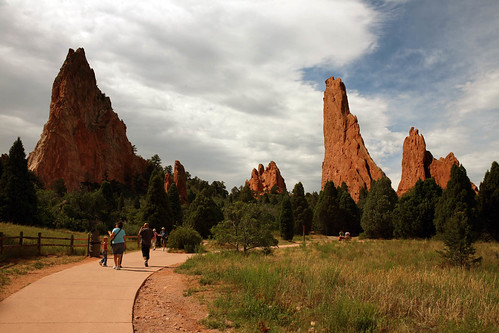
Filled with towering sandstone spires and precariously balanced rock formations, the Garden of the Gods is an excellent introduction to the even more incredible geological treasures that await travelers heading south-west. Visiting was especially fun knowing it has been a roadtrip/autotour destination for much of its existence since being opened in 1909. Compare the above picture with this one, taken in the 1950’s:
When taking my cliched but park required doing-something-silly-with-Balanced-Rock picture, I made the mistake of assuming the trying-to-push-it-over pose, only to later see tourists doing the far superior pretending-to-lift-it-on-shoulders stance. Next time, I promise I’ll get it right.
We spent some time walking on one of the paved hiking trails, which really shouldn’t be missed if you’re ever in the area. Rock climbing is allowed by permit, and we spotted several intrepid boulderers balancing along the craggy peaks.
Another formation:
Best of all, Garden of the Gods is free, having been given to Colorado Springs by the original property owners under the express condition that it permanently remain a public park.
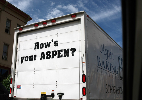
After about an hour, we left Garden of the Gods to resume our journey, passing by a joke that most likely predates the park’s many rock formations (and I’m really not sure why it’s on a baking truck).
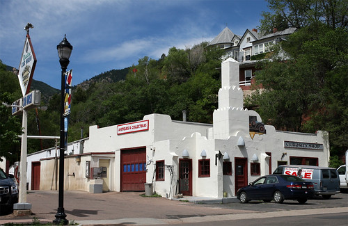
We passed this awesome gas station turned antiques shop on our way out of town:
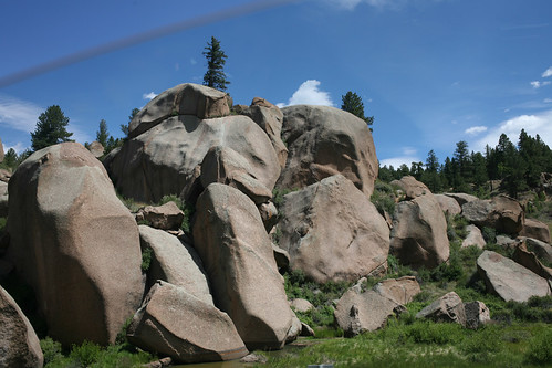
As we continued on, I never got tired of the seemingly endless number of impressive rock outcroppings of all shapes, sizes, and colors, gracing the roadside:
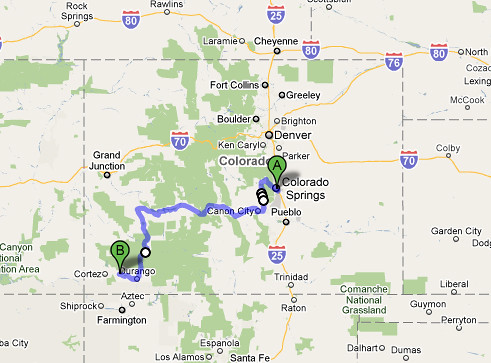
Rather than take the most direct route back to US-50, we decided to make a slight detour to visit Cripple Creek, then head south to ultimately rejoin US-50 in Canon City:
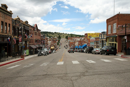
We arrived in Cripple Creek around noon. Formerly a prosperous gold-mining town, Cripple Creek drifted into ruin after the mines dried up and nearly became a ghost town, only to reinvent itself in recent years with tourism and gambling.
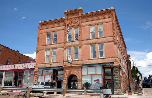
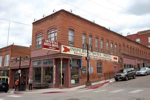
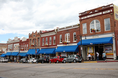
Gold was first discovered in the area in 1890, and over $500,000,000 was estimated to have been dug out over time. The downtown area is now a National Historic District, and it’s not hard to find evidence of the town’s history literally carved on the buildings…
The Gold Mining Stock Exchange building, for example:
The great Imperial Hotel-Motel sign:
Though it was busy with tourists when we visited (mostly elderly, quite a lot of whom had taken up residence in front of the hundreds of slot machines throughout town), in the 1970’s and 1980’s, the population had dropped to only a few hundred, with most of the buildings having been abandoned. Gambling saved the town when it was approved in 1991, though pretty much all the interiors have been fully gutted (and seriously, Billy, could we get rid of the terrible blue awnings?).
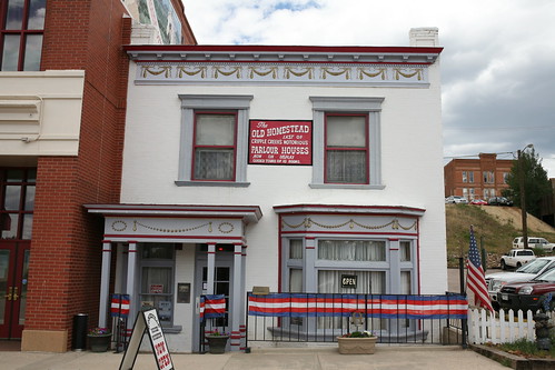
It was in Cripple Creak that we visited one of the most entertaining and impressive historical homes I’ve ever been to: The Old Homestead, an incredibly well-preserved whore house just one block from the main drag.
The Old Homestead was one of Cripple Creek’s most expensive and renowned “parlour houses” of its day (a night with a companion cost upwards off $5,000 in today’s money). After more than 10 years of servicing men who had became insanely wealthy from Cripple Creak mining operations, it closed its doors in the early 1900’s and was sold. Thankfully, the new property owners decided to keep most of the furnishings and interior decorations, and later opened it as a museum.
I wish I could show you pictures of the interior, from the original beds in each girl’s room on the second floor (a lavish photograph of each prostitute hanging above the headboard) to the windowed room where the girls would show themselves off for men to choose; from the Tiffany lamps in the living room to the Indian head cigarette dispenser in the parlor…but unfortunately, pictures weren’t allowed. Regardless, at only $4 for an endlessly entertaining 30 minute tour given by two elderly women with a good sense of humor, it’s one of my favorite stops on the trip thus far.
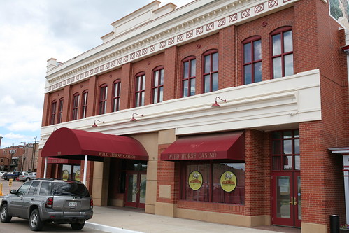
As a sidenote, the Old Homestead was nearly gutted recently by the idiotic casino owners next door who wanted to fill it with slot machines, but karma kicked them in the ass and they went out of business (though not before destroying the house’s dining room to create office space). The Old Homestead non-profit group is now applying for grants to raise the $400,000 needed to purchase the property and guarantee its existence for generations to come.
We decided to reconnect with US-50 via the ominously named Phantom Canyon Road, which takes a winding path south. Phantom Canyon Road is part of Colorado’s Gold Beltway, a connection of roads (many unpaved) that once connected gold mining districts together with the Arkansas Valley.
Traveling along any of the Gold Beltway routes, you’re guaranteed to come across ghost towns, abandoned mines, and dilapidated houses dating to more prosperous times.
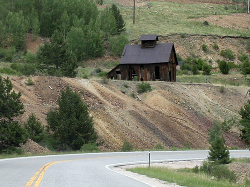
One former minehead we saw in the distance as we approached Phantom Canyon Road…
…and up close. I wish we could have trekked up the mountain to see it, but the DO NOT ENTER signs were intimidating.
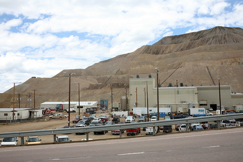
Today, gold mining does still occur in the area, though the wood shack look has been replaced by a much more bland industrial feel:
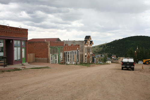
Just before reaching Phantom Canyon Road, we passed through the blink-and-you’ll-miss-it town of Victor, which is what I imagine Cripple Creek to have been like prior to the legalization of gambling. While the Main Street is in good shape and seems to cater to the occasional tourists passing through (though many of the storefronts were completely empty)…
…it’s pretty much the only paved road in town, with side streets still unpaved to this day despite being lined with commercial buildings.
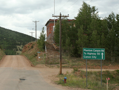
Finally, we reached Phantom Canyon Road and the end of pavement.
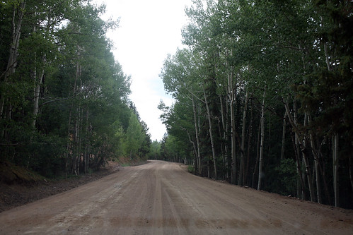
Phantom Canyon Road follows the path of the former Florence/Cripple Creek narrow-gauge railroad track, which was instrumental in transporting gold out of the area and making a lot of men very wealthy.
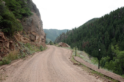
Though not as bad as Pike’s Peak, Phantom Canyon Road still made for some perilous driving. We regularly found ourselves mere feet from unfenced cliff drops of hundreds of feet. Also, the road frequently narrows to just one lane, often at the worst time imaginable (say, when curving by unfenced cliff drops of hundreds of feet).
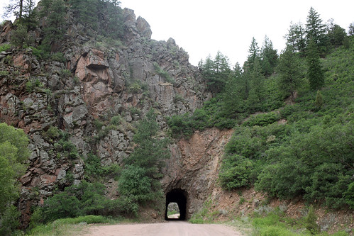
However, the drive was well worth it, with a ton of amazing views and lots of great surprises, like this incredibly narrow mountain tunnel:
Inside the tunnel, through which millions of dollars worth of gold ore once passed:
A single-lane bridge:
Passing through dynamited rock face:
All that remains of the Florence and Cripple Creek railroad is this steel bridge, which was built in 1894. According to a nearby plaque, a runaway train left the tracks at the Steel Bridge in 1901, taking 9 cars worth of ore into the ravine below (the engineer was killed). Rock slides were frequent problems, and in 1912, a 30-foot wall of water rushed through the canyon, destroying twelve bridges and leading to the demise of the railroad line.
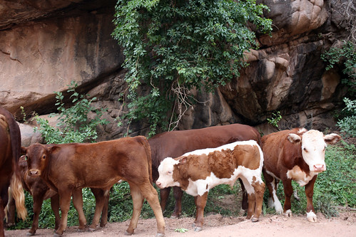
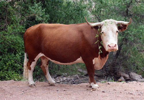
As we neared the town of Florence, we came across of a herd of cattle blocking the road.
They seemed entirely ambivalent to our city-slicker picture taking:
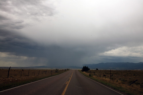
As we rejoined US-50, we caught sight of another storm in the distance (still impressive to me to see it only affecting an isolated area):
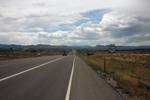
But, like every storm we’d encountered in the midwest, it passed within 20 minutes, and the skies quickly cleared:
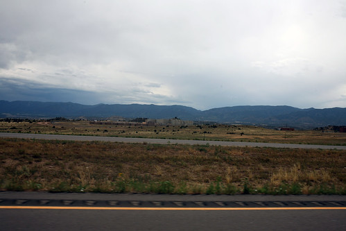
We passed through Canon City, famous as being home to 9 state and 4 federal prisons (many of which you can see from US-50). Er, we decided not to spend the night here…
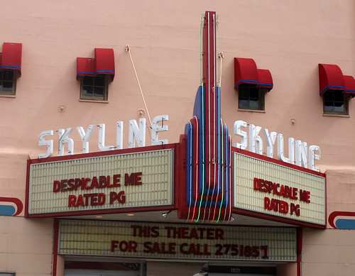
…though we did pass through Canon City’s main drag, where we found the awesome stucco Skyline Theater:
The marquee (no history on this one, sadly):
Canon City also had a bit of a wild-west feel, with its share of western clothing outfitters and saloons:
Shortly after, US-50 began following the Arkansas River, which became my favorite stretch of the entire highway.
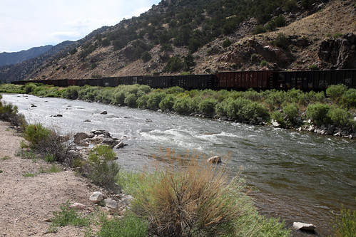
Towering mountains ascend on on either side of the road, the river rages below, and endless lines of freight cars lumber past on the northern shore:
With temperatures in the 90’s, I couldn’t resist exposing my paleness to the world with a quick jump in the Arkansas, which very quickly brought my internal body temperature down about 30 degrees.
We continued to follow US-50 as it passed through the San Isabel National Forest.
At this point, I was seriously concerned about the car, which had been struggling ever since we entered Colorado. I’ve been told that cars and trucks actually “get used to” dealing with the altitudes over time, though I don’t think our Accent was on board with that plan.
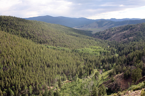
More views from US-50:
We pulled into Gunnison, Colorado for dinner. One interesting fact about Gunnison: during the 1918 Spanish Influenza epidemic, the town completely isolated itself for two months. Highways near the town line were barricaded, and train passengers were warned that if they got off in Gunnison, they’d be arrested and quarantined for five days. As a result, not a single Gunnisonian died during the epidemic.
An enormous ring found randomly next to a sidewalk:
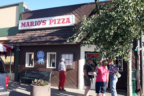
We ate dinner at Mario’s Pizza, which was hopping with locals and had apparently won awards for Best Pizza, Best Hamburger, and Best Waitresses.
As we’ve traveled further west, I’ve found that more and more locals are very happy – eager, in fact – to engage in good-natured conversations with total strangers, at length and often about nothing more than, say, the weather, or the cost of gas. While I found it a bit disarming at first, by Mario’s Pizza, I was happily conversing with anyone interested in a good chat, from waiters to gas station clerks (much to the dismay of my girlfriend, who frequently pointed out that in every single case, I was spending a tremendous amount of time saying very, very little).
We were eating our Mario’s pizza in a lot across the street (great pizza, by the way) when I looked up and realized where we’d parked the car. Our Hyundai Accent: the white stallion (er, when it’s willing to get up the damn mountain already).
We decided to take a major detour off of US-50 to hit the four-corners area ( where Utah, Colorado, Arizona, and New Mexico meet) to see the many incredible sights there. For our route, we chose to follow US-550, more famously referred to as the Million Dollar Highway. Known for its incredible views, insanely steep cliff drops, hair-pin turns, narrow lanes, and very slow speed limits, it also has no guard rails.
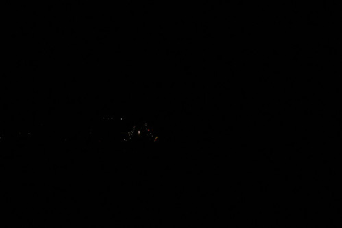
The drive turned out to be very, very precarious, in part because our view out the window was this for the entire 3-hour journey:
Yup – despite our best efforts, we weren’t able to reach it before nightfall (those lights are from the small town of Silverton), and had to navigate the entire thing in pitch black. Occasionally, as we swung around a turn, our headlights would illuminate a cliff drop and reveal just how close to death we were. Also, deer absolutely LOVE to run across US-550, and we had to swerve on at least five or six occasions to avoid totaling the car.
Finally, we pulled into Mancos, Colorado, around 1 AM, absolutely exhausted from driving what is considered one of America’s most beautiful byways and having seen barely any of it.
-SCOUT




















Thanks Scout. Great pictures and commentary! I’m hoping we can get an out-west road trip planned in the next few years.
By they way, during your commentary of Cripple Creek, CO the song “Up on Cripple Creek” by the band The Band kept popping into my head. Now I’ll have that as an ear-worm all day.
I was just in Colorado Springs last month, and I really liked the road up to Woodland Park (Hwy 24) that had a small rocky stream running down between the eastbound and westbound lanes.
I love the four corners area. Mesa Verde is worth the trip and hike. The whole area just oozes with ancient history and pre-history.
I’m sorry you didn’t get to see the views from the Million Dollar Highway they are spectacular (and really scary at times).
Congratulations on crossing the Continental Divide. You’re now officially “out west”.
As I read that you were going to Gunnison, I wondered if you would find Mario’s, and of course, you did! It’s a shame you missed seeing Hwy 550 in daylight, and I’m stunned that you skipped the Royal Gorge Bridge, the quintessential tourist oddity. I know, you can’t see it all, and you’re seeing some great sites. And sights. Keep on truckin’!
I can’t say enough about what a wonderful virtual trip this is! Are you considering putting this into a book form? It is a marvelous story.
I love Colorado! For a while the company that supplied the software to my employer was based in Boulder, so I traveled there often. Never expected to fall in love with it!
My grandmother was born in Leadville, CO in 1896. My sister met me at the tail end of a business trip a few years ago and we explored, doing some genealogical research while we were there. It is a fascinating area. There wasn’t much data to be obtained, the Hall of Records burned down in the 1940’s. But we visited the Catholic church that the family attended while they lived in Leadville, before moving first to Denver in 1900 and then to Prince Edward Island a year or so later. That is where my great grandparents were originally from. I can’t imagine traveling across the United States with 5 little girls, all under 10, in 1901! Compare it to your trip today!!
Thank you so much for sharing your adventures!!
Great stuff, Scout.
So enjoying these entries. Do be careful about trespassing in/around abandoned mine sites. What looks like a field may actually be the caving-in ceiling of mine tunnels. Found this out the hard way near Ophir. 🙂
Just gorgeous! I’m enjoying tagging along on your trip … I haven’t been out West since travelling with my grandparents as a kid. (Well at least by car … I’ve had a few air trips to LA, SF, and San Diego, which don’t count) 🙂
I just read in the newspaper day before yesterday that Four Corners was closed and how folks had driven hundreds of miles only to be greeted by a sign. I think you can check it out on Navajo(?)Reservation website, which is the only place that this info is posted on since they’re in charge of it! Really enjoying the trip!
Would you please help out a non-native speaker – what’s “How’s your Aspen?” a pun on?
(I’m pretty sure it’s obvious, but I did have a long day. (Already, woo, timezones.)
I went to College in Durango and if you get a chance, you should stop and see Durango and Silverton. Durango has a couple of great Victorian Hotels. In the winter, families would board up their homes and move to the hotel. Silverton, to this day is usually cut off for a couple of months during the Winter due to avalanches on the pass. Keep up the entries! I really miss that part of the world! There really is nothing like waking up in the morning and having a lynx peeking in the window at you!
A ghost hunters group’s web site has a few photos of the Homestead’s interior:
http://www.sgha.net/co/cripple/homestead.html
Love your blog!
It’s just as well that the old mine site was posted against trespassing. Old mine shafts are tempting to explore, but they’re also very dangerous (not just cave-ins, but poisonous air too).
You really didn’t miss much by not seeing Four Corners. I went there and was very disappointed. And it turns out that Four Corners really isn’t accurate anyway. They found out that the real place where the 4 states meet is actually 2.5 miles away!!
http://www.msnbc.msn.com/id/30327372/
Great pictures and stories my friend. Safe journey and thank
you for making my day a better on. brian
i am researching a past life story about the west about a woman who may have run a whorehouse in meeteetsee wyoming and this was great to review and get a flavor of the area she probably crossed over.thankyou for sharing your journey!
Hey not to set off topic but can anyone give me a review of. New York Car Insurance Reform 295 Greenwich St, New York, NY 10007 (646) 351-0824 They are down the block with me. I was wondering once they were a good insurance company. I need to find coverage, it is the law you know, but I need to have a good price price plus I’d prefer friendly service.
The old wooden mining shack is a really cool picture. We have some here in CA, where I reside. I just love these kinds of pics.