Last week, I was scouting for woodland trails, which brought me up to Van Cortlandt Park in the Bronx. I’d never been before, and I randomly picked a trail and just started walking.
A little ways in, I noticed something unusual off to the side of the trail…
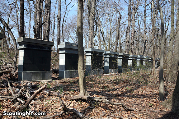
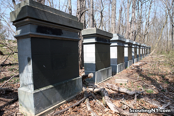
…A row of what almost looked like oversized gravestones:
There was something a bit weird about stumbling on these seemingly randomly placed structures in the middle of the woods. Could this be New York’s version of Stonehenge??
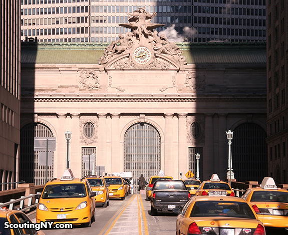
As it turns out, the answer actually has something to do with a little building you may have heard of in Manhattan…
These thirteen slabs are stone samples, from which the primary building material for Grand Central was chosen. The samples were brought to New York City to test how they withstood the elements, though ultimately cost proved to be the deciding factor. Indiana limestone, the second sample in from the south, was chosen because it was the cheapest to transport:
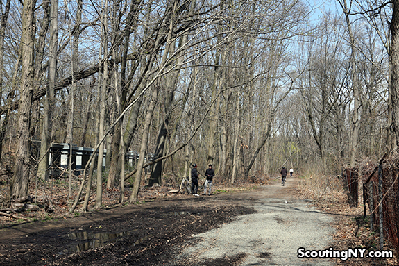
That answered part of the question – but why were they hidden along a random woodland trail? In fact, it’s not random at all – the trail I was following was actually built on top of an old train line.
According to Forgotten NY, the Putnam Line once ran from the Bronx all the way up to Brewster, New York. One of the coolest remnants from this can be found near the trail’s southern end…
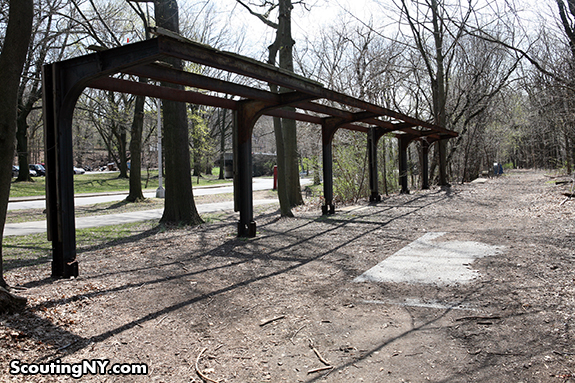
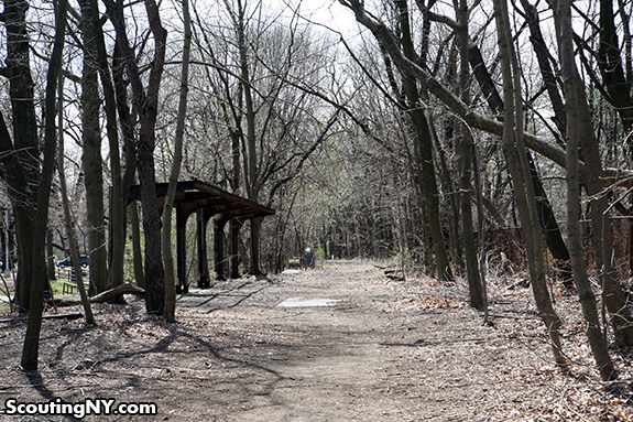
The rusting remains of an old train station:
This was once the Van Cortlandt Park stop, one of two stops in the Bronx. So interesting to stand here and force your brain to picture it as a fully active railroad station…
Construction on the Putnam line began in 1870, with passenger service in operation until 1958. Freight trains continued to use the line through the early-1980s, when it was finally decommissioned.
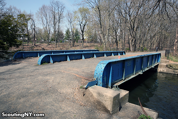
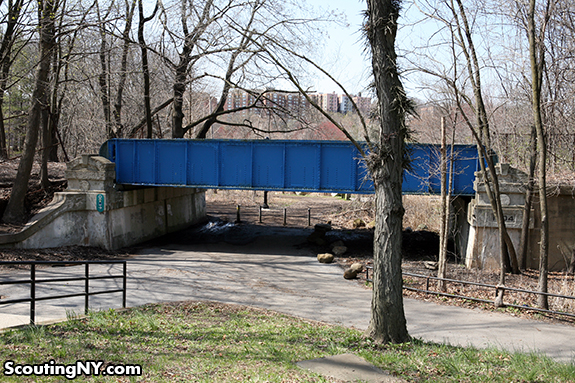
In addition to the station, several iron bridges can also be found along the trail:
Here’s hoping those passing through the park late at night might hear what almost sounds like a train whistle blowing in the distance…And perhaps, see spectral figures waiting at the station for a train that will never come.
Click here for info on visiting the trail!
-SCOUT







When I was a kid in Yonkers, the section between Van Cortlandt Park and Lawrence Street was called “the tracks” even though the trains, tracks and the Lowerre Station were long gone.
Very nice find!
Hi,
The Putnam Line ran through my hometown, Briarcliff Manor. While the rail bed was still there, and the occasional work train would barrel through, it was not a working commuter line later than say the late 50s? The station became the town library and the right of way is now a poplar bicycle path in Westchester. As usual, thanks four your cool posts.
Mike Scully
The Putnam Line brought visitors to Van Cortlandt House Museum just up a rise to the north and west of the train station. And to answer your question, you can still hear train whistles in the distance but they’re from the Metro North tracks that run along the Hudson River.
Love your “finds”.
I love this trail and have walked it many times, especially in the spring. If you take it to the Yonkers border, you can (carefully) climb a hill up near McClean Ave and get a coffee and Danish at the 7-Eleven nearby.
BTW, Cornelius “Commodore” Vanderbilt died in 1877 and was buried in an elaborate tomb near his Staten Island birthplace, so I doubt he had anything to do with picking out the stones for the current (1913) version of Grand Central. Unless he did so from the grave which, knowing him, may have been entirely possible!
He built the Grand Central that preceded the current Grand Central…so yes, unless those date from the 1870s instead of the 1910s then it wasn’t him.
My money is on his grandson William Kissam Vanderbilt who was the head of the family and thus the head of the New York Central in the 1910s when the new Grand Central was built.
Nope, they’re from the 1910s, which means quite a lot of my sources have brought old Cornelius back from the grave 🙂
I wouldn’t put it past him Scout! There’s an fascinating bio of The Commodore called “The First Tycoon” by TJ Stiles, and it follows Vanderbilt from his humble Staten Island birth to his rise to wealthiest man in America. If you haven’t read it yet, check it out.
Well they at least had the right family, just not the right generation 😀
I love Van Cortlandt Park. It’s one of the jewels of the Bronx and NYC. It’s also amazing how many abandoned rail yards there are in the region.
Van Cortland Park is a historic place. Back in the late nineteen-fifties, my buddy and I found a revolutionary-era brass bullet mold poking out of the ground. I later learned that troops had camped there.
If you’re looking for trails in NYC, look at the former Vanderbilt Motor Parkway between Cunningham and Alley Pond Parks in Queens:
http://maps.google.com/maps?&ll=40.736088,-73.751843&spn=0.015218,0.032551&t=m&z=16
http://www.treebranch.org/BQGG_pdf/alleypond_forttotten.pdf
http://www.nycgovparks.org/parks/alleypondpark/dailyplant/14967
We used to ride bikes on a section of the Old Motor Parkway frm New Hyde Park Rd east to Shelter Rock Rd. I think it may still be there
Wonderful place to walk, jog, bike. You can still spot some of the concrete barrier posts sticking out of the ground.
I think it takes a right turnon Francis Lewis Blvd., before Cunnigham Park. I believe it’s actually in Alley (Pond) Park. Correct me if I’m wrong
There’s a current ebay listing a 1063 picture of the RR stop
http://www.ebay.com/itm/RARE-5×7-KODAK-PRINT-NY-CENTRAL-RR-PUTNAM-DIVISION-VAN-CORTLANDT-PARK-APRIL-1963/140961113508?_trksid=p2045573.m2042&_trkparms=aid%3D111000%26algo%3DREC.CURRENT%26ao%3D1%26asc%3D14996%26meid%3D7191168243337765215%26pid%3D100033%26prg%3D7275%26rk%3D1%26sd%3D140961113508%26
That should be a 1963 picture…
While the Putnam line’s lack of a useful Manhattan terminal and, later on, the lack of parking at most stations pretty much doomed it as a commuter line, it did have one virtue: it offered the only route into the city for high-and-wide freight cars. With its abandonment came the end of such access. That’s why you won’t see double-stack container trains any closer than New Jersey.
I think it’s great those two pictures have been taken 50 years apart. Kinda sad though, too. We have some tracks here east of Seattle that have been decommissioned. Most recently had just been used for Santa train and dinner train to wineries – that channel will probably also be used for urban trails. While at the same time, they have just moved to make a brand new light rail that won’t go nearly as far north and is who knows how long from starting or being completed… I’m sure there is some reason.
Jenni, it’s called bucks. If there is a way to make some from the LRT trust me they will. Development tends to follow these things.
In the 1970s, I used to hop freight trains right there. Since I live near the park, I often run or hike there. That stretch of trail always has the strangest people there. It’s quite strange – maybe it’s the Commodore taking different forms.
So am I the only person who wants to know if all the rock samples have weathered well?
these tracks were operational past 1980 Metro north used to store some work trains near stella dora’s , also behind the westchester county bee line depot used to sit an old rail car on those tracks and even in westchester further north the tracks were still visible. I’m only 41 btw lol
The bike path mentioned, now goes all the way past Carmel NY in Putnam County. You can still see some of the old phone poles and other artifacts along the trail. If you go, stop at the Freight House Cafe in Mahopac for really good coffee and baked goods or sandwiches.
The “Old Put” was an interesting railroad to say the least! It was originally going to go from The Bronx all the way to Montreal (!) but the Panic of 1873 derailed any thought of that so it just made it to Brewster, NY to connect to Boston and the NYC Harlem Line at Putnam Jct. BTW, it is interesting that about 10 miles of graded but never laid rails existed from Carmel to Holmes, NY on it’s roundabout way north and went through Lake Carmel.
Joe Schiavone wrote some nice historical books on the Old Put and archival movies are surfacing due to increased historical interest in what was this railroad.
Last commuter run on entire Putnam was May 1958. Last through freight was in Sept. 1962. Putnam line was dismantled in pieces. Middle of it taken out after Sept. 1962 from Eastview to Mahopac. Mahopac to Carmel removed in 1969. I remember the Upper Putnam when Penn Central was killing it that ran from Mahopac to Brewster with the odd small extra freight rumbling along no faster than 10-15 MPH. Carmel to Brewster removed in 1973 but the last revenue run was in March 1970. Chauncey (south of Ardsley) to Eastview abandoned in 1977 with tracks removed later for the rail trail. Chauncey to Van Cortlandt was removed in 1983(?).
All that is left of the Put is very short stubs existing in the Bronx and in Brewster as a turning wye.
It’s a pretty rail trail now. Very scenic. It is not a straight or a flat railbed: it’s hilly for a former railroad and winds almost roundabout, especially in Putnam County.
It’s a shame in a way it was abandoned when it was. It could have even been rebuilt to be a decent commuter railroad. Folks in Mahopac and Yorktown Heights, for instance, would have an easy commute in to GCT just by throwing a switch at Marble Hill. Or they could have connected to the Harlem line near Hawthorne.
Reading the comments re the “Put” were interesting. I spent many hours in and around the Van Cortlandt station. There was a horse stable to the left of the station and horse trails thru the park all the way up to Woodlawn Cemetary. Riding thru the woods was a special treat for us.
Also ice skated on the lake to the right and did sleigh riding on the golf course hill. The golf house, next to the lake, was a refuge from the cold and sipping hot cocoa, listening to “skaters music” and watching the skating while warming up was fantastic. There was a flag pole outside the house and a white flag with a big red circle was flown when the ice was thick enough for skating. The flag did not fly during WW II because it looked like the “Rising Sun” Japanese flag.
Rode the train to Elmsford several times. My in-laws had a store there and used the train as a “commuter”. Also rode to Brewster to a “teen camp”. The conducter for the mid-morning run was Joe Casso, my friends dad. My mother-in-law rode the “last train” to run on the line.
The area surrounding the station was a wonderful outlet for sports, hiking and picnicing. There are BIG changes since my childhood.
Another great trail was the viaduct – north of DeWitt Clinton (it contains the water pipes that run into the Sedgwick Reservoir) The viaduct was a great way of getting to Tibbetts Brook pool. We started the hike early – stopped to picnic – spent the afternoon swimming and took the bus back to the B’way city line.
I believe the reservoir was a race track in the late 1800’s.
Thanks for allowing my “memories” to meld with the “Ghost Railway”.
The Putnam Line intrigued me from the time I was a young child. When I was a young boy riding in the car on the Saw Mill River Parkway, I wondered about the railroad track alongside the Saw Mill River Parkway. One time I saw a train on it when I went ice skating at Woodlands and this must have been late in 1968 or early in 1969. When I got a little older, my father told me that those railroad tracks where the New York Central Putnam division and that passenger service ended a number of years ago at the time. In time, I found that the Putnam division went to the Bronx and I first laid eyes on the Van Cortlandt Park station in 1977. Even at that time, only the skeleton of the canopy remained though it was in a little better shape than it is now and there were still tracks in place. I saw a train run through Van Cortlandt Park in April 1979 pulled by locomotive 9955. A few years later the last train ran on the Putnam Line. I finally got a taste of the Putnam Line in late October 1991 when I rode my bicycle on the portion from Eastview to a point a short distance north of the Hawthorne interchange which must have been near the Graham Hill station. Then when a substantial portion of the South County Trailway was opened, I rode my bicycle from Farragut Ave. in Hastings to a point near the Ardsley station. Even to this day, the path still has some remaining evidence that it once was a railroad. You’ll still see the occasional telegraph pole. There are remnants of the station at Mt. Hope in Hastings-on-Hudson. One of the more interesting remnants of the Putnam Line is in the vicinity of the Tarrytown Heights station. The line ran behind some of the buildings of the former Marymount College (now EF school). It looks like the embankment was specifically built for a railroad. The Tarrytown Heights station was where the skating shed now stands.
The Yonkers Branch of the railroad separated from the main line in Van Cortlandt Park, and headed northwest to Getty Square. The neighborhoods at the train stations were great examples of what we now refer to as “transit-oriented development.” Parking was unnecessary because relatively dense clusters of buildings surrounded the stations.
You can still see the Yonkers Branch rail bridge over the Henry Hudson Parkway, and imagine the trains destined for Getty Square.
The New York & Putnam Railroad was quite clever in transit-oriented development. The Park Hill neighborhood of Yonkers was developed by the railroad company, whose tracks and station were at the bottom of Park Hill. To serve Park Hill, the company constructed an incline funicular railway to bring people up and down to the Park Hill Train Station. The funicular stations still exist, and now serve as residences. The largest house on Park Hill was built for the president of the railroad company, next door to the upper station of the funicular.
Other cool vestiges of the railroad still exist, if you know where to look. Joe Schiavone’s book covers it very well. (Groundwork Hudson Valley, a community organization in Yonkers, often gives walking tours of these sites.)
The Caryl Station spot is now a parking lot, but Caryl Avenue is still a bridge covering the railroad tunnel below. Much of the tunnel has been turned over to parking for a post-railroad apartment house.
The Lowerre station was raised up from the street, and stone abutments from its location north are still present.
At McLean Avenue (near South Broadway), you can see the stone abutments on the north side of McLean in Sutherland Park where the railroad bridge over McLean reached the rail path. And the path is still there, below where the Hendrick Hudson Hotel once stood. The hotel, destroyed by fire, was built by Bruce Price, the same architect who built the magnificent Chateau Frontenac in Quebec City, Canada.
In Getty Square, the original headhouse and shed station was replaced by an office building and platform — 20 South Broadway. This beautiful office building is still there, with an exterior covered in lovely embellishments featuring the trains that it served. The train platform is now a parking structure that service City Hall and Getty Square..
When I was a kid, there were still some sections of track in VanCortlandt (my 2nd backyard) and in Yonkers. There is a map of stations and more info on Wikipedia.
http://en.wikipedia.org/wiki/New_York_and_Putnam_Railroad
Your readers and commenters should know that the Putnam Trail along the former RR track isn’t just a “bike trail.” The path runs through what remains of Van Cortlandt Park’s wetlands, and most users are walkers and people who want to enjoy the birds, turtles, and other nature features that many neighborhood folks wouldn’t otherwise get to see. The Park Department plans to cut down the trees, widen the path, and pave it to make it more like Central Park — more friendly to (speed-based) recreation and to commercialization. Anyone who cares about nature should oppose these plans.
As a child my class took a field trip to Van Cortlandt Park and I remember walking on the tracks. This was in the1970’s