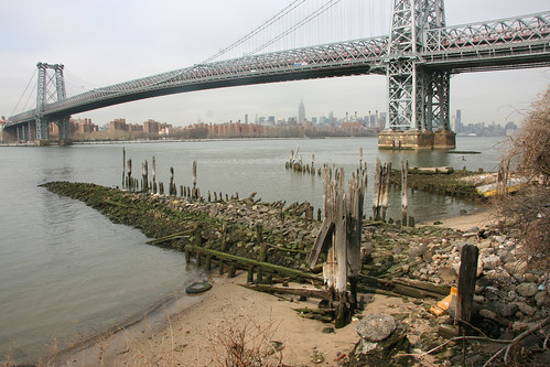
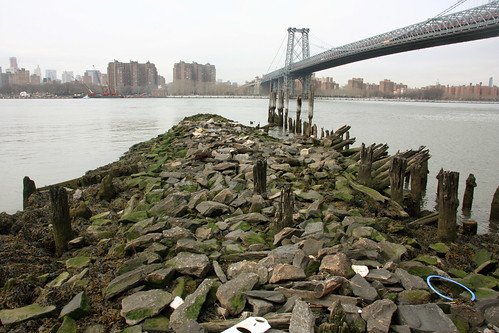
Though it borders the East River, no one really thinks of Williamsburg as a beachside community. But go behind some of the buildings on Kent Ave, climb down this rickety ladder taking care not to kill yourself on the rocks below…
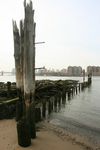
…and you’ll find that Williamsburg does indeed have its own beach!
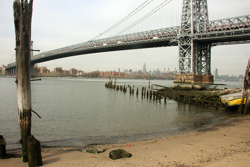
Sure, it’s not particularly large…
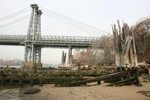
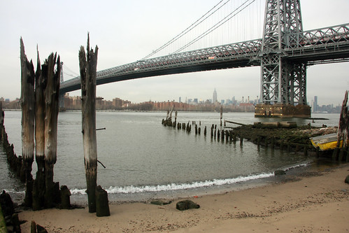
…but it’s got a great view of the Williamsburg Bridge:
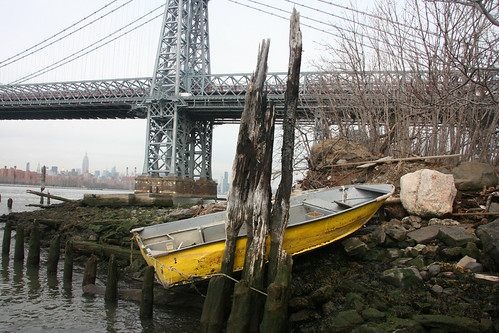
And if there’s any question to its legitimacy, a little farther down the beach…
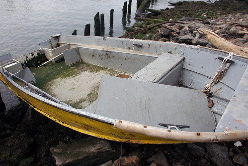
…someone has a boat moored!
At least, I think it’s moored. It may have just washed in with the tide.
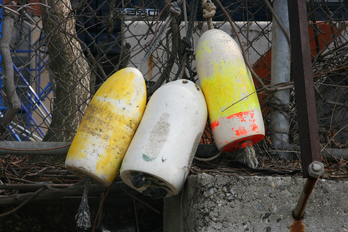
And topping off the seaside air, three buoys hang artfully on a rusty chainlink fence:
OK, it’s not a particularly impressive beach, but there’s just so many in this part of Brooklyn!
There are actually a few of these scattered throughout the East and Hudson Rivers – random outcroppings of sand and decaying dock wood, which are among my favorite “abandoned” New York properties (I wrote about one at East 20th Street several months ago). There’s something endlessly fascinating to me that the land right up to New York’s coastline is worth untold billions of dollars – and then you hit the beach, and it’s just forgotten decay.
But this all clearly meant something to someone once – what was it?
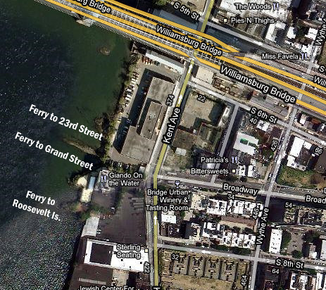
HUGE thanks to reader Brooks for explaining this one – this is the former site of the Brooklyn Ferry Company’s Williamsburg Branch! From here, you could catch ferries to 23rd Street, Grand Street, and Roosevelt Island (map from 1886):
I’ve labeled where the docks used to be below:
The largest remaining portion is this enormous rock outcropping, which is visible on the 1886 map as separating the Grand Street and 23rd Street docks:
The Brooklyn Ferry Company began service on May 4, 1857.
In fact, at one point, the Broadway El train (now the JMZ) ended at the ferry!
On October 14th, 1907, the NY Times reported that the Brooklyn Ferry Company had unexpectedly announced that all Williamsburg service would be discontinued. Now, over 100 years later, it looks like a new ferry will soon be operating.
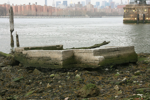
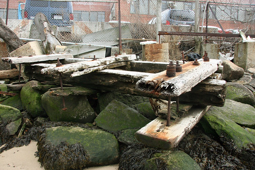
So fascinating to think that millions of Brooklyn residents once crossed the river into Manhattan here, and yet you’d have no idea by looking at its current state. The random flotsam and jetsam is pretty interesting, like this massive concrete frame:
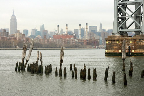
Lots of ancient wood and iron:
A weird piece of God-knows-what perched on some rocks:
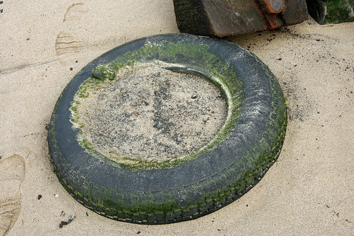
And of course, tons of tires:
More junk from the river:
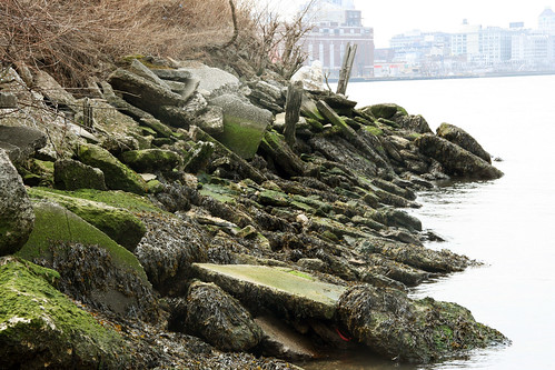
The beach eventually tapers off into the rocky outcroppings that make up most of Brooklyn’s coast:
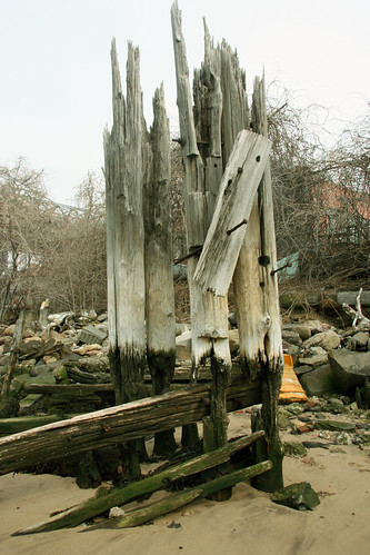
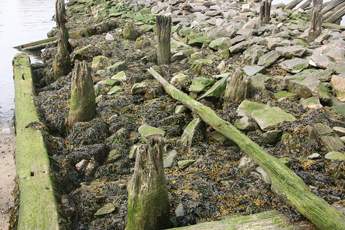
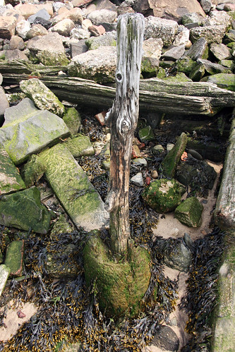
More post stubs poking up through the rocks:
This withered post is firmly embedded in a hunk of cement.
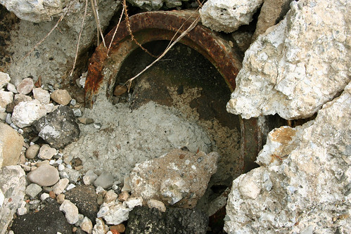
An old stopped up drain pipe:
It’s always kills me that water plays such a major roll in New York’s geography, and yet it’s completely off limits for swimming. I remember visiting Chicago for the first time and being blown away that people were actually swimming in Lake Michigan.
I always wonder if someday (a distant someday), future New Yorkers will look back on us with pity for having only been able to enjoy the river as a view.
-SCOUT
PS – One of my most difficult scouting assignments – trying to figure out which city agency controls these little beaches. As far as I can tell, none.











This site (Broadway/Kent) apparently used to be one location of the New York Ferry Company. The posts held up piers where you could catch a ferry to 23rd, Grand, or Roosevelt.
http://digitalgallery.nypl.org/nypldigital/id?1512452
http://digitalgallery.nypl.org/nypldigital/id?1517436
THANK YOU! Always appreciate your help with the maps.
Anytime. Glad to contribute!
One correction, though: that lower ferry slip actually went to the now defunct Roosevelt Street (http://en.wikipedia.org/wiki/Roosevelt_Street_%28Manhattan%29), not Roosevelt Island.
Looks a bit like the Astoria Park “beaches” between the Triboro and the Hell’s Gate bridges
As a Chicagoan on a 18 year tour of the rest of the U.S. The fact that you can swim in the Lake has a lot to do with it being a source of the drinking water. The really navigable and industrial rivers and canals that connect to the Mississippi — the Calumet, the Chicago Shipping Canal, the forks of the Chicago River — you aren’t going to want to swim in. The water was reversed to keep it out of the Lake on purpose, but the rivers themselves have a long and dirty history.
(My father worked for a company, Chicago Rawhide, that was downstream from the old stock yards and began life by fashioning industrial tools out of the discarded carcasses of cattle that were sent to float down the river.)
Wait – they reversed the Chicago River?? How the heck did they do that??
Wait – they reversed the Chicago River?? How the heck did they do that??
Through the use of canal locks. It was done many decades ago, so the technology can’t be too complex.
The reversal isn’t complete; some river water enters Lake Michigan, but not enough to impair water quality.
It’s the sort of “beach” where human stiffs float up from time to time.
wonderful post as usual. Your last bit about swimming reminds me of when I found some young girls (obviously not from NYC) SWIMMING in the east river off of one of those rocky beaches. I guess they have clean water or something where they come from… I told them that where they were swimming was not safe and in fact, the rocks were infested with rats which are very bold. They thought I was trying to spoil their fun until a group of local little boys wandered down with big bricks to throw at said rats,( I guess this is what kids do after school), and killed one right in front of them.
there’s a similar abandoned beach in Long Island City. Guess they’re all over the City if you care to danger the rocks…
my shot:http://greenwichvillagenydailyphoto.blogspot.com/2010/10/pilings.html
I always used to hear stories about my father swimming in the East River when he was a little boy in the 30s. We always thought it was so strange, but now I realize it’s strange and sad that we can’t.
Great post!
One of my most difficult scouting assignments – trying to figure out which city agency controls these little beaches. As far as I can tell, none.
My guess would be Environmental Protection, Parks & Recreation, or Citywide Administrative Services.
What a nifty spot. When I was a kid we used to let my dog go for a swim but I wasn’t allowed in the water. He died from leukemia about 8 years later and I always wondered if there was a link.
so glad to have found your site. Wonderful post.
Yeah, that little rocky beach along the East River (Scout did do a post on that one): I have seen people swim there too, from time to time. During summer people swim around the beach in Fort Washington Park, just next to the Little Red Light House and the GWB. The Hudson, also no tea water.
New York’s rivers are bizarrely underused. I’m amazed at how few marinas there are. Why aren’t the rivers used for transit? Fast catamaran ferries would be far cheaper and faster to implement than the 2nd Ave subway as a method of moving people from the upper east side to downtown. The rivers are New York’s true last frontier.
This. I’m always amazed we don’t have more ferries. Or even boats. I sit out in Gantry Park in Long Island City and watch the river and always find it amazing how empty it is compared to what you would expect.
As for the water quality, I read an article somewhere recently about attempts to reintroduce oysters to the rivers to help clean the water. So maybe one day.
There are lots of little beaches all around the city… my family lived on Governors Isl (Coast Guard, lots of boat time)plus we kayak: the perspective from the water is completely different and quite amazing: Herons the size of mythic rocs taking off from rusting car wrecks, for example, or one of the sure signs of spring: Buttermilk Channel ‘floaters’ (yuch!)
Terminology correction: According to international maritime regulations, “flotsam” is defined as anything that falls off a ship while “jetsam” is anything that is thrown overboard from a ship. Neither word has anything to do with “floating” or “sinking”.
There’s a neat little beach on the very Northern tip of Manhattan, in Inwood Park, between Henry Hudson bridge and a railroad swing bridge. The sand is a bit oily, but if you want that “away from it all” vibe, it’s pretty good.
I’ve gone skinny dipping a few times in the east river – usually in the early morning before sunrise, and I’ve never understood quite what the big deal is. It’s just water. If you don’t have any open cuts on you I’m not sure what terrible thing is supposed to happen. All over the world, people swim in way dirtier water without incident.
Anyway, this site is just awesome. Thanks.
Is it considered trespassing to go here? Can you be arrested for it?
Just Stumbledupon the site. Hugely enjoyable. Thanks for your efforts.
Gary
UK
Perhaps my fave series of pics you’ve posted. Urban archaeology at its finest!
FINALLY I found the kind of website I was searching for. Not that Empire State or such buildings aren’t cool, but I wanted to see hidden places, secret treasures.. and HERE they are! Thanks for the share, I’ll follow your posts until my next trip to New York 😉
Catherine, Mtl
I read somewhere that there’s an annual swim around Manhattan, so people do swim in the rivers. I personally wouldn’t want to step in it, but I think it’s probably more of a result of urban legends than based on the actual possibility of anything bad happening to me.
Is it still there, after the hurricane?
Or was it washed away?
How do I get to this beach
My father and his brothers grew up in Redhook Brooklyn. They always told stories of swimming off the docks there. He even dove in once and cut his chest open on a sunken car door. He was fine after running to the local pharmacist who sewed him up! I’m sure if I look through some of the old pictures there some of them diving in!!they used to swim to the Statue of Liberty and back! Tough guys!